
How to Measure Land Area with Your Phone
You can estimate land area with your phone by placing points on a satellite map or walking the outline with GPS. Map tracing depends on the imagery and how you place each point; walking depends on the phone’s position quality. Neither method has one guaranteed accuracy. Both can help with a rough acreage or materials estimate, but they cannot establish a legal property line.
This guide shows both methods, explains where the error comes from, and shows when you need more than a phone. The examples use Dipper Area Measure by InsightSpatial, our free app for iPhone, iPad, and Android, but the ideas apply to any measuring app.
Can you measure land area with a phone?
You can. A phone can measure area in two different ways, and it helps to know which one you are using:
- On the map. You place the corners of the land on satellite imagery. The phone’s own location is not used at all. Accuracy depends on how sharp the imagery is, how well it lines up with the ground, and how carefully you place each corner.
- On foot. You walk the boundary, or stand at each corner, and the phone records its GPS position. Accuracy depends on the phone’s GPS, the sky above you, and how you hold the phone.
Use the map when you can clearly see the boundary from above and do not want to walk it. Walk it when the boundary is hidden under trees, when the imagery is old, or when you are on site anyway.
Method 1: Tap the corners on a satellite map
- Open a new area measurement and choose the map method. In Area Measure this is Map tap, or Crosshair if you want to place each point precisely under a fixed target.
- Zoom in on the first corner until you can see the fence, edge of the field, or other marker clearly.
- Place a point on the corner. Work around the boundary in order, placing a point at every change of direction.
- Close the shape. The app shows the area, perimeter, and the length of each side.
- Zoom in and check each corner. Drag any point that sits slightly off the real corner.
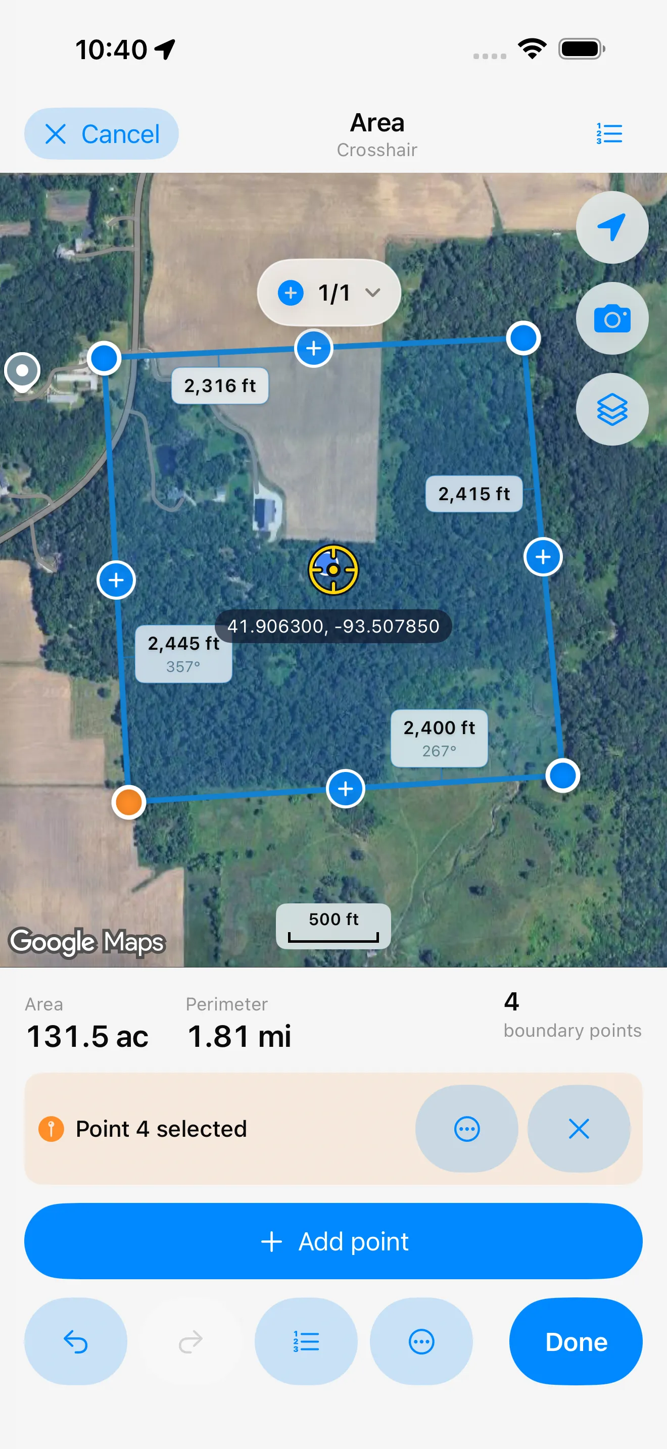
The map method is fast and needs no walking, but it has two hidden sources of error. First, satellite imagery is never perfectly aligned with the ground. A shift of a meter or more is common, and more in hilly areas or where the imagery is old. Second, a single screen pixel covers a real distance on the ground. If the imagery is blurry at the zoom level you need, your corners are only as precise as the blur.
Tips for better map measurements:
- Zoom in as far as the imagery stays sharp before placing each corner.
- Place corners on things you can verify on the ground, such as fence posts and the corners of buildings.
- Check the result against a known length, such as one side of a building, before you trust the total.
Method 2: Walk the boundary with GPS
- Start a GPS measurement. In Area Measure, choose Walk an area with GPS to let the app record your path as you walk, or Mark each corner with GPS to stand at each corner and save one point at a time.
- Go to the first corner. Hold the phone steady and away from your body, with the top of the phone facing the sky.
- Wait a few seconds for the position to settle before you capture a point. Area Measure shows the accuracy behind every point and filters out poor fixes.
- Walk to the next corner and repeat, all the way around.
- Close the shape and review the area, perimeter, and side lengths.
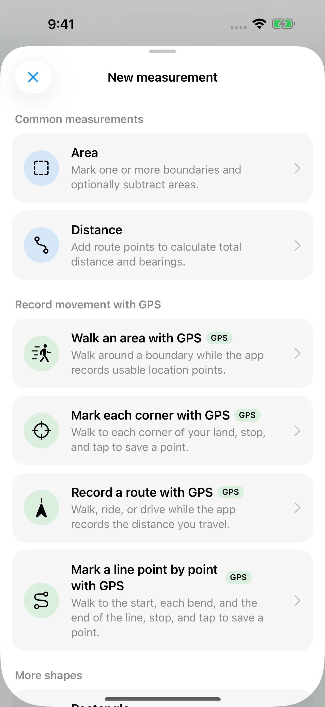
Standing at each corner is usually more accurate than walking continuously, because you give the GPS time to settle at the places that matter. Walking the whole boundary is useful for curved edges, such as a creek or a winding fence line.
GPS works best with a clear view of the sky. Trees, buildings, and steep slopes block or reflect satellite signals and make the position jump. If one corner is under a tree, stand a few steps into the open, capture the point there, and adjust it later on the map.
How accurate is a phone measurement?
According to GPS.gov, GPS-enabled smartphones are typically accurate to within a 4.9 m (16 ft) radius under open sky, and accuracy gets worse near buildings, bridges, and trees. Each corner you capture can be off by about that much, in any direction.
The effect on area depends on the size of the land: the error sits along the boundary, so the bigger the area inside it, the smaller the share. Here is a worked example with two square pieces of land, a one-acre lot (about 63.6 m or 209 ft on each side) and a 40-acre field (about 402 m or 1,320 ft on each side):
| If every side of the outline is… | One-acre lot | 40-acre field |
|---|---|---|
| Exactly right | 4,047 m² (1.00 acre) | 161,874 m² (40.0 acres) |
| 1 m too far out | 4,305 m² (1.06 acres), about +6% | 163,488 m² (40.4 acres), about +1% |
| 3 m too far out | 4,846 m² (1.20 acres), about +20% | 166,738 m² (41.2 acres), about +3% |
The same 3 m error adds about 20% to the small lot but only about 3% to the large field. This is an illustration of a consistently enlarged outline, not an accuracy forecast or a worst-case bound. Real errors can cancel, shift an entire outline, or distort it. The example shows why the same position error can matter more on a small plot.
Acres, hectares, and square feet
Measuring apps convert units for you, but it helps to know the numbers:
| Unit | Equals |
|---|---|
| 1 acre | 43,560 sq ft · about 4,046.9 m² · about 0.405 ha |
| 1 hectare (ha) | 10,000 m² · about 2.471 acres |
| 1 square mile | 640 acres |
| 1 square meter | about 10.764 sq ft |
A quick check for a rectangular lot: multiply length by width in feet and divide by 43,560 to get acres.
When do you need more than a phone?
Start with a phone for rough planning, then decide whether the possible error is acceptable. A few meters may be a small part of a large field, but a large part of a garden or small lot. Check important dimensions before ordering materials.
If you need to mark planned positions or revisit sample sites precisely, compare a compatible RTK receiver with other appropriate measuring methods. RTK needs corrections, internet, and suitable satellite conditions; it does not make traced satellite imagery more accurate.* Our guide Phone GPS vs RTK: how accurate do you need to be? helps you decide, and Dipper Go by InsightSpatial is the RTK receiver we are building for exactly these jobs.
Is a phone measurement legally valid?
No. A measurement from a phone, or from any app or receiver you use yourself, is an estimate. It cannot establish a legal property line, and it should not be used to settle a boundary dispute or prepare a legal description. For that, hire a licensed land surveyor in your state.
* Centimeter-level positioning requires a compatible RTK receiver, a correction service, an internet connection, and open sky. Actual results depend on equipment and conditions. Map tracing depends on the imagery and where you place points.
InsightSpatial apps and devices are for measuring, layout, and record-keeping. They do not replace a licensed land surveyor and should not be used to establish legal property lines.
Products mentioned: Dipper Area Measure · Dipper Go